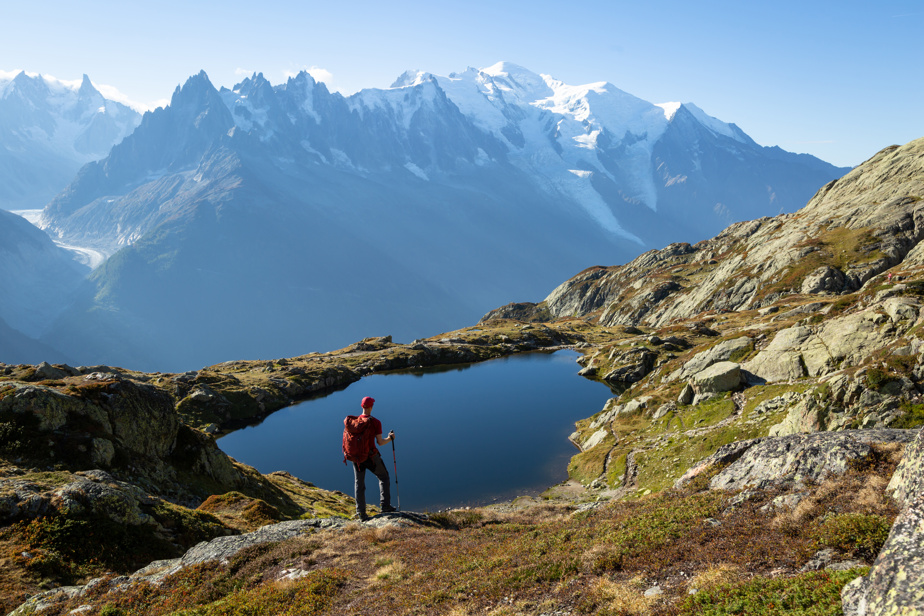
The Mont Blanc. The Matterhorn. The Eiger. These are legendary peaks that inspire mountaineers, both novices and professionals. But they are also at the heart of networks of particularly enticing hiking trails. Small families, novice hikers, athletes looking for a good challenge and long-distance hikers can all find what they are looking for.
In all three cases, a lively village can serve as a base camp and there is absolutely no need to bother with a car because the trails can be easily accessed on foot, by train or by cable car. The villages themselves are accessible by public transport. For those who care about their ecological footprint, this is valuable.
With an altitude of 4809 meters, it is the highest point in Western Europe, on the border between France and Italy. You can set up home in Chamonix – Mont-Blanc or in another of the villages in the valley. The easiest way to get there is certainly to take a shuttle from Geneva airport in Switzerland.
Once in the valley, hikers can travel free of charge from one village to another by train or bus using a tourist pass card provided by the hotelier. This allows access to the various trailheads and cable car and gondolas stations. This is one of the great pleasures of hiking in the region: thanks to the ski lifts, you can gain a little altitude and start hiking beyond the tree line. You can take the Aiguille du Midi cable car, descend to Plan de l’Aiguille, hike on the Grand Balcon Nord trail and descend into the valley by taking the Montenvers train.
For those who like long hikes, the tour of Mont-Blanc is inevitably a must.
At 4,478 meters above sea level and its massive pyramid shape towering over the Swiss village of Zermatt, the Matterhorn is another mountaineering must-see. Located on the border of Switzerland and Italy, it is called the Cervino in Italian and the Matterhorn in English and German.
Zermatt can easily be reached by train from Geneva or Zurich. Cars are strictly prohibited in the village and it is so concentrated that everything is easily accessible on foot.
The trails can be accessed from the village itself or from the cable car stations. Several paths lead to a refuge where you can treat yourself to a good snack on a terrace, or inside if the weather is more chagrin. It is thus possible to hike to the Hornli refuge and, at the very beginning of the afternoon, to witness the return procession of the mountaineers who got up in the early morning to climb the Matterhorn. It is by the expression of their face that we can see if they have reached the top or not.
Quebec hikers may be a little surprised by the description and signage of hiking trails: the length of the trail in kilometers is not always mentioned. Rather, we give the time necessary to walk the trail. Thus, it takes an average of two hours to do the very pretty trail that connects the Schwarzsee and Trockener Steg cable car stations.
Long-distance hikers can walk from Chamonix to Zermatt, but this is a high mountain hike that involves mountaineering knowledge and the use of ropes, crampons and ice axes.
The legendary north face of the Eiger rises above the village of Grindelwald. Entirely in Switzerland, the Eiger (3970 meters) forms a shock trio with the Mönch (4107 meters) and the Jungfrau (4158 meters).
Here too, the train is the preferred mode of transport from Geneva or Zurich and between the various hiking areas.
As in Chamonix and Zermatt, it is a good idea to stop by the visitor center to pick up a map of the village and a map of the trails. There’s nothing like a map of the entire industry to make an informed choice. The Eiger Trail, between the Eigergletschner and Alpiglen stations, allows you to pass just under the north face of the Eiger. You can also choose to take a bus and go hiking in the mountain pastures on the other side of the valley, and thus have an unequaled perspective on the Eiger. And on some friendly Swiss cows.
Mixed climbing consists of alternating rock and ice in the same ascent. Swiss mountaineer Yannick Glatthard demonstrates this.
This is the number of peaks over 4000 meters in the Alps.


